
Mapping Urban Spatial Structure using multi-source geospatial data
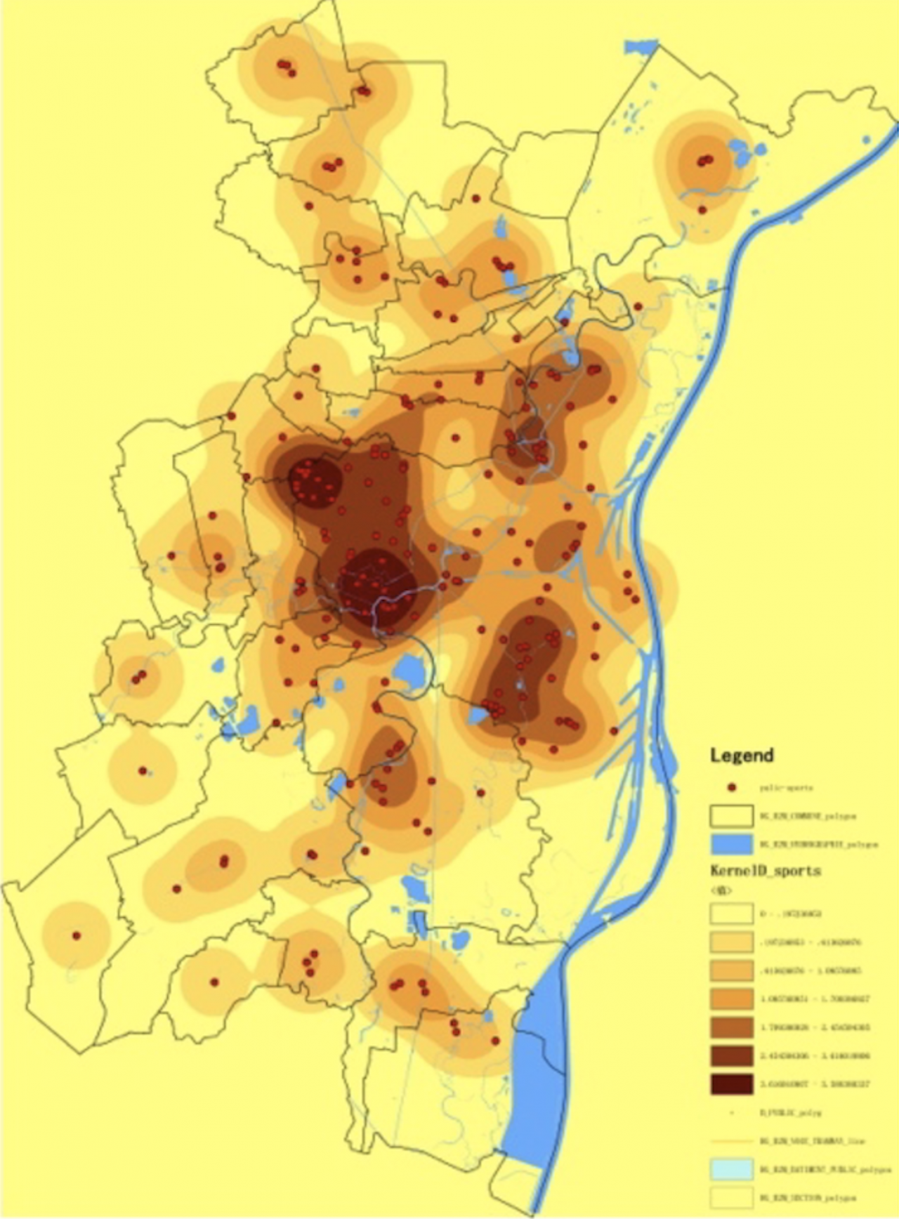
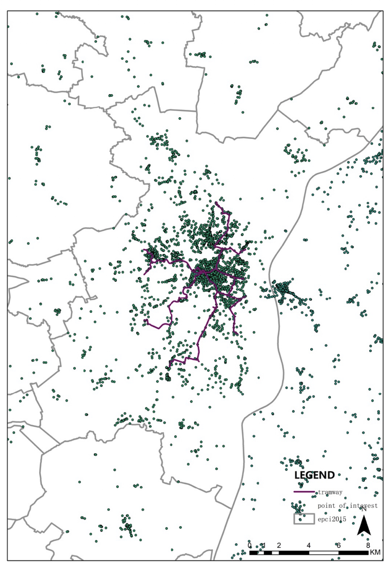
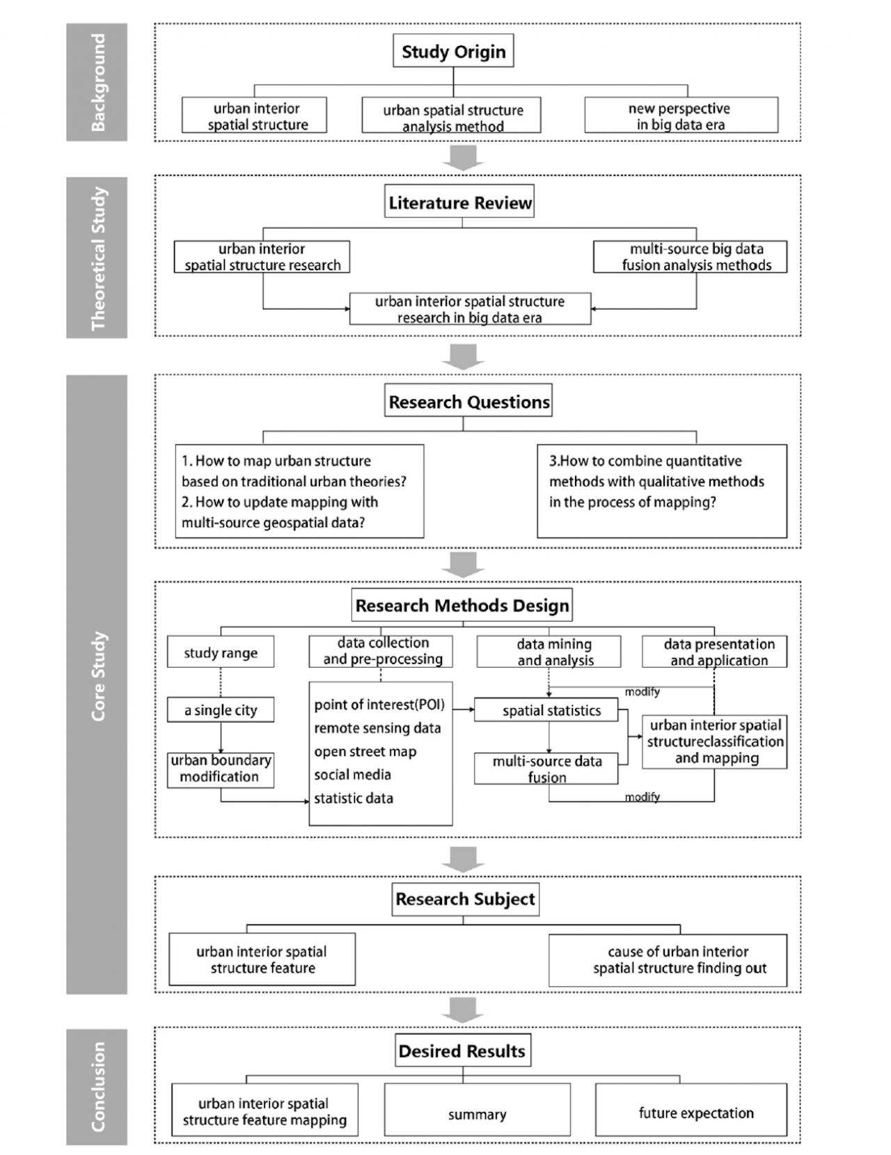
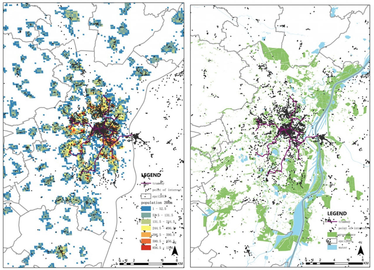
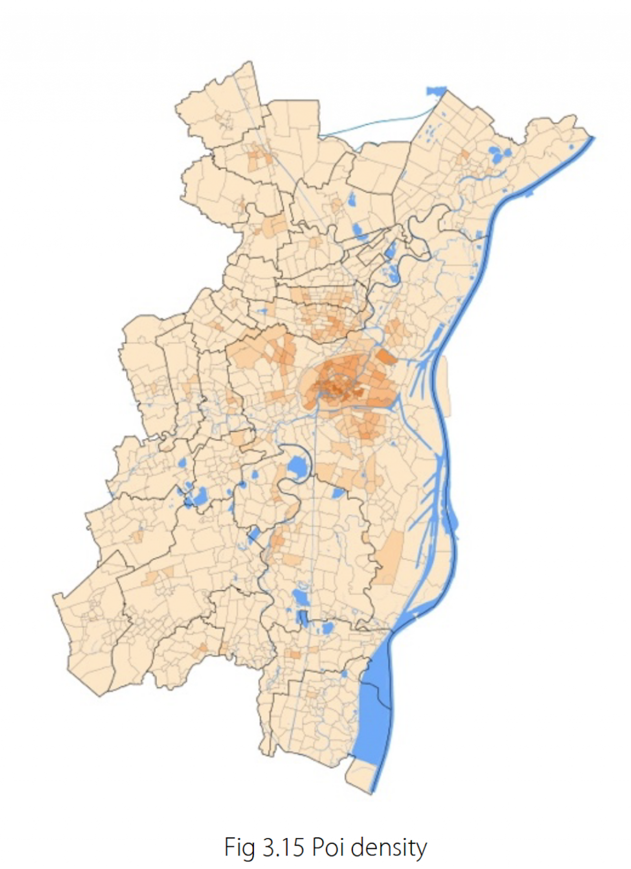
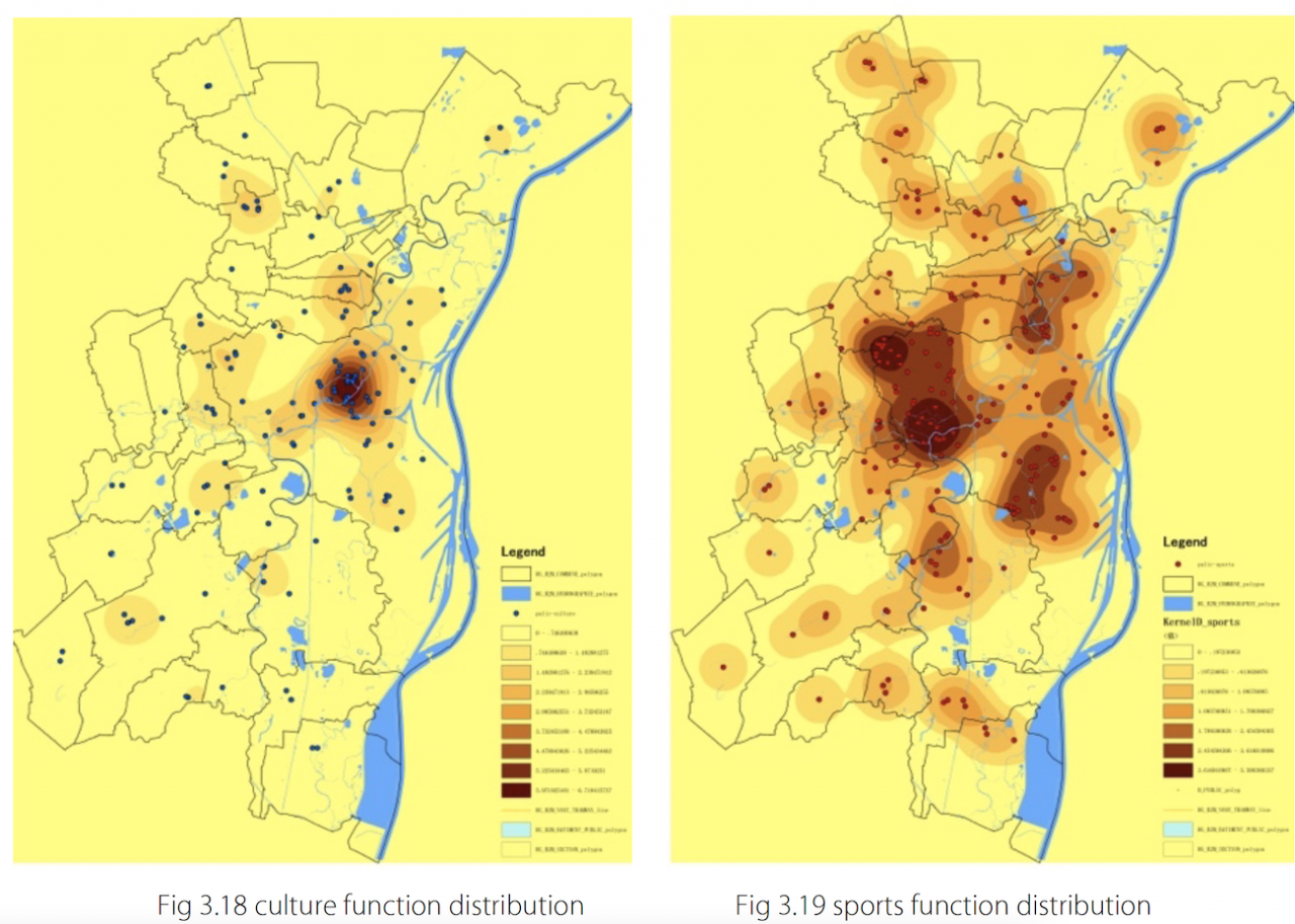
Urban spatial structure is one of the most important topics in urban planning. The optimization of urban spatial distribution is one of the most employed means to solve urban problems. With the coming of big data era, this type of analysis brings opportunities for understanding urban perceptions and spatial practices and establishing diagnosis by combining it with the traditional mapping methods. This thesis tries to review the advantages and disadvantages of mapping with geo-spatial data and took Strasbourg as an example to produce and interpret mapping on urban spatial structure with POIs (points of interest), remote sensing data, population distribution data and so on. The following aspects were mapped - urban growth situation, demography, urban activities and natural elements distribution as well as different urban functions - and then cross-analysed with the geo-spatial data maps, revealing how Strasbourg metropolis is structured as well as its areas of potential. The thesis shows the interest of mapping with geo-spatial data in the field of urban planning and design, especially with regard to more traditional urban analysis methods.
Academic partners
CAUP Tongji
ENSA Strasbourg

Organizers
Thesis Defense :
CAUP Tongji _ June 2019
ENSAS Defense _ June 2018