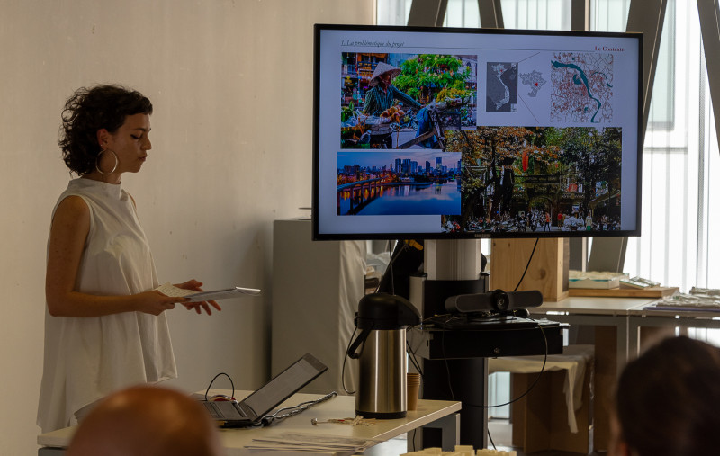
“Hanoi, nước City“
Considering that the risk of flooding is expected to increase considerably due to climate change, this project seeks to examine how best to manage water related risks in the City of Hanoi, Vietnam.
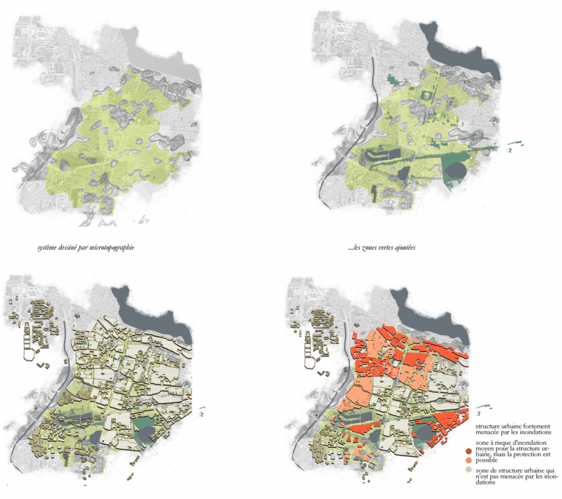
The project focuses on the downtown area of Hanoi, where the most difficult situations in terms of flood-prone areas, occur. The design concept is considering increasing the space given to water as a new spatial structure for the city, while also reconnecting with a local cultural of water that has been progressively erased by the urbanisation process. The local micro-topography allows to reveal the natural watershed system as the project's geographical base. Furthermore, new natural infrastructures - vegetal corridors and water dominant environments - are imagined in order to regain soil porosity (unseal urban surfaces) for water absorption while also fighting against heat islands. These new infrastructural elements, also become the support for soft mobility patterns.
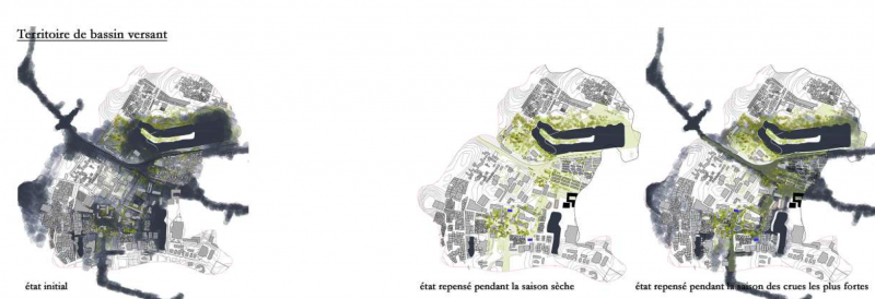
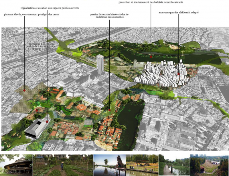
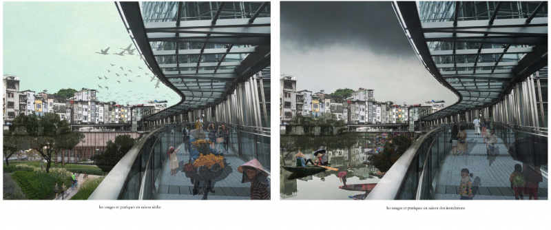
The design is further detailed on the scale of the watershed were a "project of the ground" draws micro-topographical modifications, insuring spaces for high water levels during the rain season while also conserving plateaus which are always dry and protected from floods. The renewed relationship to water and to the city's natural ground is opening the possibility for reconnecting with the local know-hows and practices: reintroducing urban agriculture, local markets and flexible open multipurpose public/shared spaces and waterscapes.
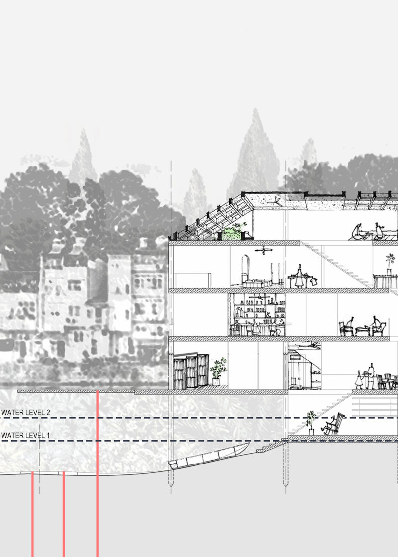
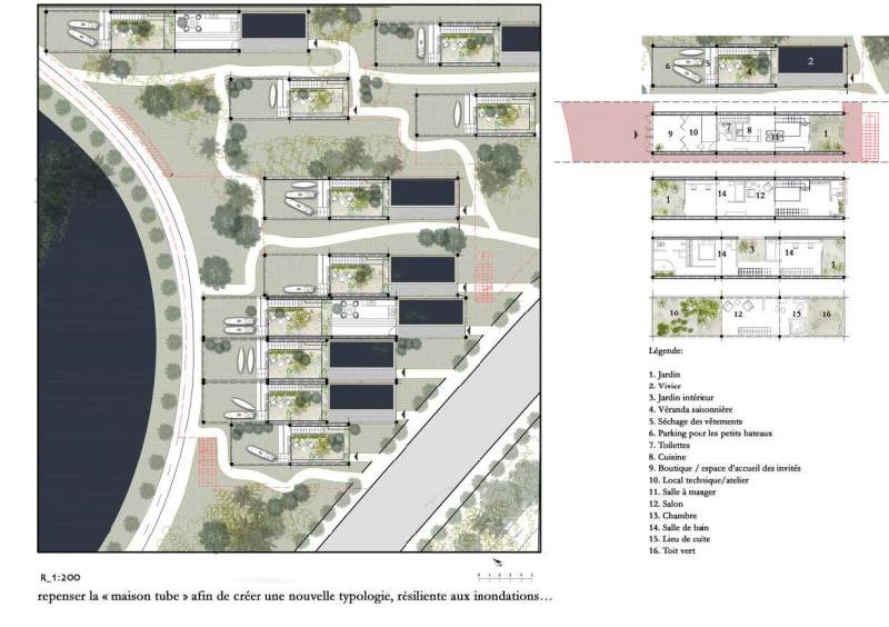
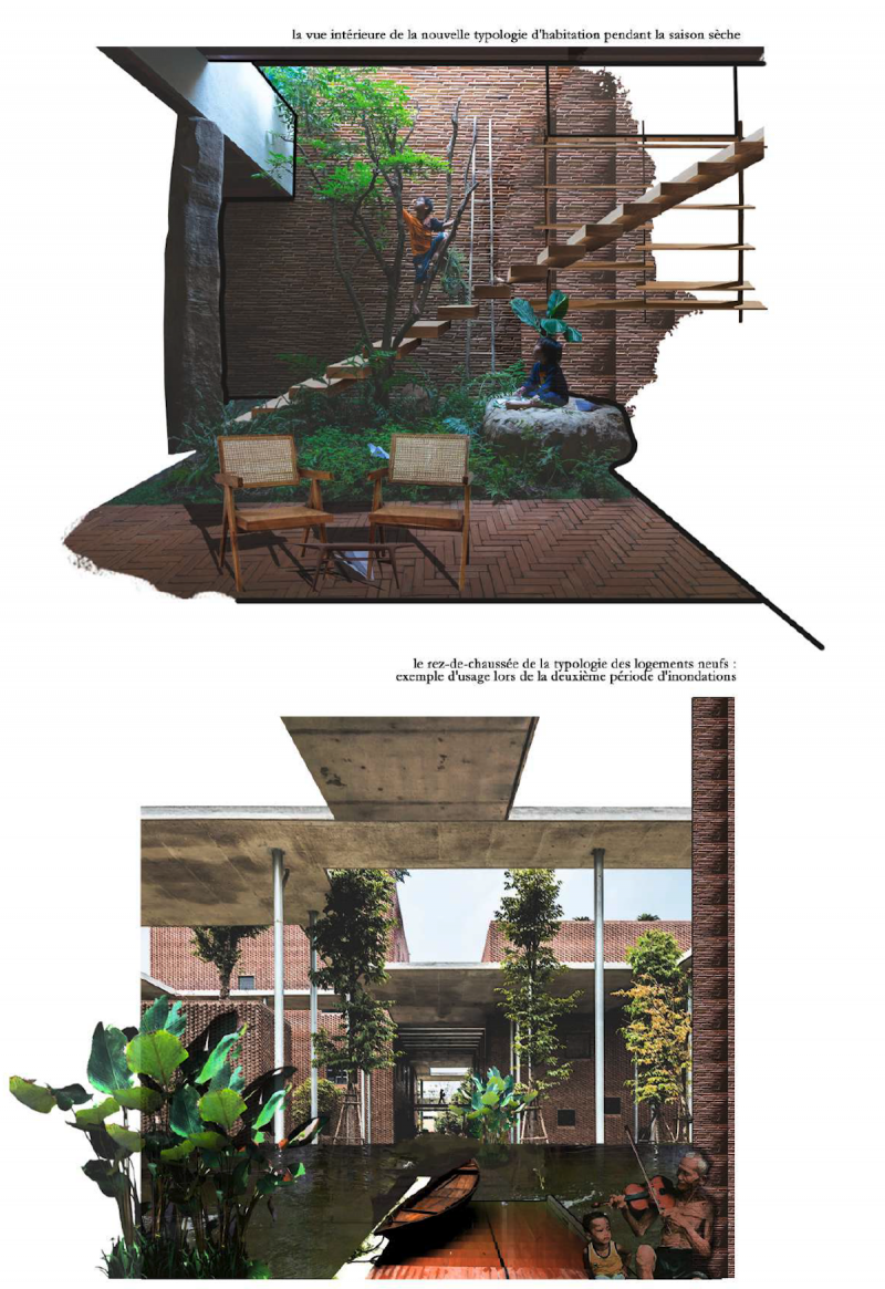
On the micro-design scale, the project considers locally specific every-day uses and social practices in order to re-interpret local spatial typologies - from open public spaces to the intimacy of an individual dwelling - as well as their evolution according to different temporalities - rainy periods and dry periods.


